The Lost Basin Mining District
The History of the Lone Jack Gold Mine
Introduction
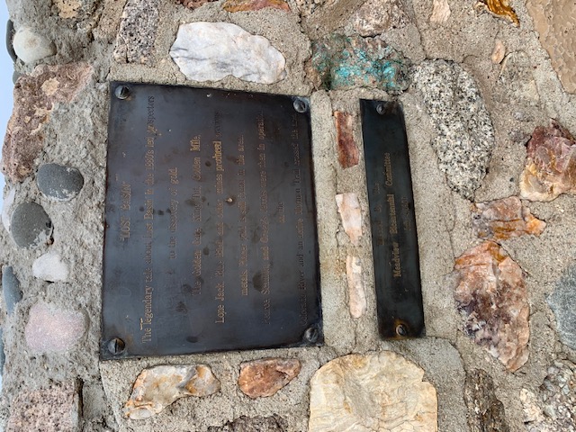
The Lone Jack is a placer gold mine in the Lost Basin Mining District of northwestern Arizona. It was never a large operation, and it remains a small-scale surface placer claim today. What makes the Lone Jack worth documenting is the story it shares with dozens of similar claims across the American Southwest — ground that has been worked, abandoned, and rediscovered by generation after generation of prospectors.
This page collects what is genuinely known about the mine and its district. Where the historical record is thin, we say so; where it is documented in public sources such as USGS reporting and federal mine records, we point you to those sources directly.
The Lost Basin Mining District
Placer gold was discovered in the Lost Basin country in the latter half of the nineteenth century, and the district was formally organized around 1886. It sits in the arid high desert of northwestern Arizona, in rough granite terrain east of the Colorado River and south of Lake Mead. Its better-known neighbor, the Gold Basin district, lies immediately to the north.
From the beginning, the district's mines were placer workings. Water is scarce throughout the region, so miners relied on dry washing rather than conventional sluicing, and the scale of operations stayed small. Recorded production for the district as a whole was modest compared to Arizona's great lode camps — but the gold was real, consistent, and close to the surface, which kept prospectors returning year after year.
Working the Gravels
Nineteenth- and early twentieth-century prospectors in Lost Basin worked much as modern prospectors do. Gold was recovered from surface gravels and decomposed granite using dry washers — bellows-driven boxes that separate gold from sand by air instead of water — along with panning and simple screening. Because the deposits were shallow and the climate punishing, work was typically seasonal and intermittent.
There are no shafts or underground workings associated with the Lone Jack. Like every mine in the district, it is strictly a surface placer operation. This point matters for anyone researching the site: federal mine records list the Lone Jack as a placer deposit, and nothing in the published literature describes lode mining or significant underground development there.
The Lone Jack in the Records
The Lone Jack appears in standard public references including the USGS Mineral Resources Data System, the Mindat mineralogy database, and Western Mining History's mine records, all of which classify it as a placer gold occurrence in the Lost Basin district. These records document small-scale, intermittent activity through the twentieth century rather than sustained commercial production.
Detailed day-to-day documentation of small desert placer mines like this one simply does not survive. Claims were worked when prices and weather allowed, then left idle. That pattern — bursts of activity followed by long quiet stretches — is typical of the district and is part of what gives these old claims their character today.
The Gold Basin Connection
The neighboring Gold Basin district shares the same geological origins and much of the same history. Gold Basin is also known far beyond mining circles as the source of the Gold Basin meteorite, discovered in 1995 — one of the most productive meteorite strewn fields ever found in the United States. Metal detectorists who learned their trade hunting gold in Gold Basin went on to find hundreds of meteorite fragments scattered across the same desert pavements.
The Mine on Modern Maps
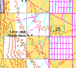
The Lone Jack remains marked on official federal mapping of the region, including the Bureau of Land Management's 2016 Arizona Strip Visitor Map. Seeing a small placer mine named on a modern BLM map is a quiet reminder that these old workings were real places in the territorial economy, not just legends.
The Mine Today
Today the Lone Jack is worked as a hobby placer mine. There is no commercial production, and nothing was ever built here — little more than a hole in the gravels and a dry washer. Work happens on a small scale: sampling gravels, running a dry washer, sweeping a metal detector over the desert pavement, and occasionally coming home with a few flakes of gold.
That continuity is part of what gives the place its character: the same ground, worked the same way, for well over a century.
Conclusion
The Lone Jack Gold Mine is a small place with a long memory. From the first dry washers of the 1880s to a prospector's metal detector today, it tells the same story the whole Lost Basin district tells: gold enough to keep people coming back, never quite enough to make fortunes — and a desert that preserves both the gold and the history remarkably well.
FAQs
-
Where is the Lone Jack Gold Mine?
It is located in the Lost Basin Mining District of northwestern Arizona. Exact locations and directions are not published out of respect for the privacy of the claim. -
Is the Lone Jack a shaft or lode mine?
Neither. It is strictly a placer mine — gold is recovered from surface gravels, with no shafts or underground workings. -
Can I visit the mine?
No. The Lone Jack is private property and closed to visitors. -
Was it ever a big producer?
No. Public records describe small-scale, intermittent placer activity, consistent with the rest of the Lost Basin district.